Urban Design
Urban Planning
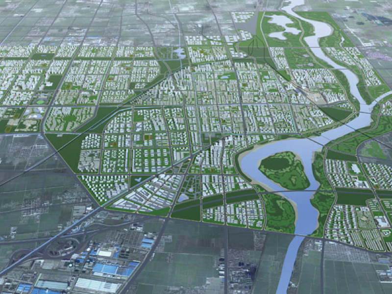
This comprehensive urban design operates across three spatial scales:
1. Citywide Scale
The 58 km² study area encompasses seven key districts: the western new town, historic center (including the traditional central axis and Fu River moat neighborhoods), eastern eco-city, Si River waterfront recreation belt, eco-agricultural tourism zone, northern integrated logistics district, and southern advanced manufacturing zone. Through field research, we systematically analyzed inter-district relationships—particularly transportation networks and open space systems—establishing development intensities based on industrial and land-use planning. The spatial framework integrates height controls, skyline analysis, and major corridors while preserving natural environmental features.
2. District Scale
For each of the seven districts, we studied spatial activity nodes and circulation paths, enhancing connectivity and transitional interfaces. Priority redevelopment sites received detailed design guidance to shape future urban imagery.
3. Block Scale
We established typological prototypes with development controls including density, height, setbacks, green space ratios, and access points.
Temporally, the design addresses a core challenge: preserving historical and cultural identity amid modernization. As a strategic transport hub, Yanzhou served as a Ming Dynasty princely capital and later a cultural crossroads where Confucian traditions met Western influences during late Qing and Republican eras. Our proposal spatially reconciles these layers—retaining historical traces while fostering contemporary openness—through deliberate urban structure and imagery.
Yanzhou
2010
5,800 hectares
/图片/原图/2.jpg)
/图片/原图/2012041610502498493.jpg)
/图片/原图/预览.jpg)
/图片/原图/2012041610504823363.jpg)