"Wandering together, never forgetting Penglai Isle, The blue sea and green hills feel like old friends. No harm if the layout falls slightly short, Better yet when the city walls stand complete. Like pearls shining with equal brilliance, Future abundance may surpass the past."

— Wu Yanyin, Modern Educator

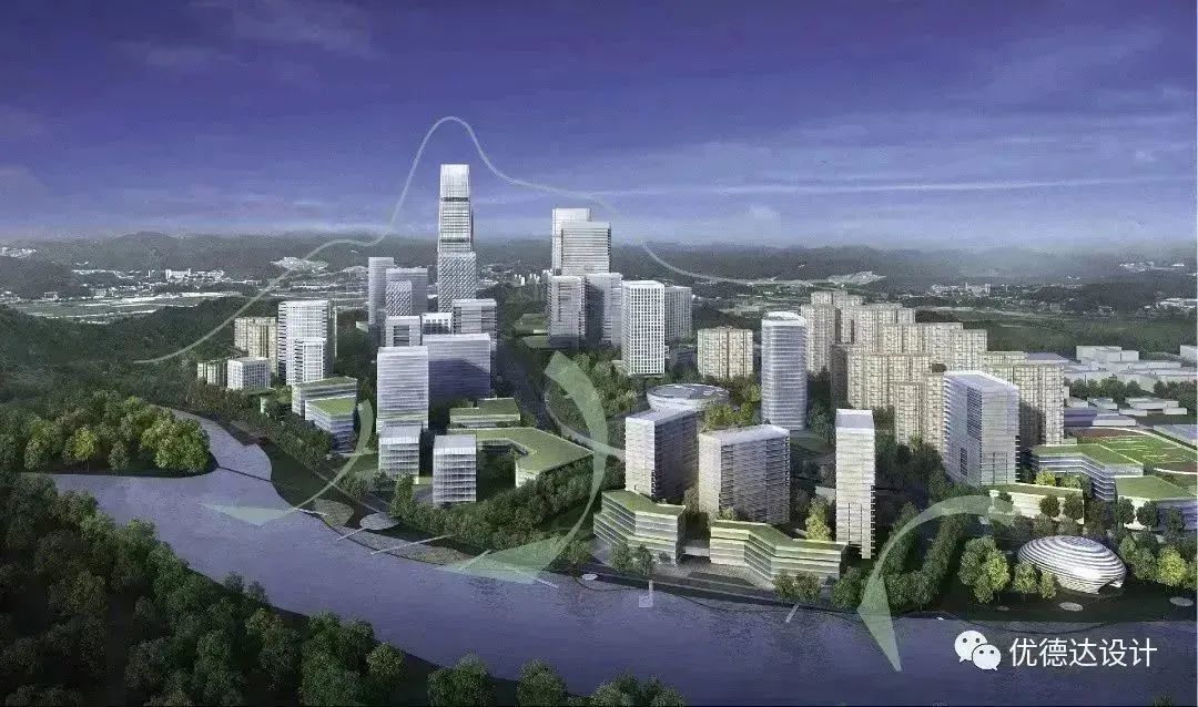
Urban design aims to strengthen a city's unique value, including its natural and cultural characteristics—the very essence that sustains its existence and enduring vitality. It forms the foundation for economic development, community prosperity, and ecological balance. Qingdao remains as radiant in memory as ever, having evolved through German and Japanese occupations, the Republican era, post-founding reconstruction, and rapid urban expansion after reform and opening-up. Our design scope covers the birthplace of modern Qingdao—Xiaogang, Zhonggang, Dagang, and the vast hinterland of the historic urban area. This built environment is like a spatial chronicle, embedding the living and cultural memories of different eras, from diverse foreign influences to the vibrant local culture of places like Taidong. Amidst the tides of history and epochal changes, our urban renewal design seeks to highlight the profound and distinctive value of such areas while bridging the spatiotemporal fractures caused by urban development and expansion. This has been our central focus, and we are committed to proposing viable solutions.

Comprehensive Urban Renewal Design Strategy

We base our approach on three dimensions—economic competitiveness, environmental friendliness, and improved urban services—to establish five spatial design strategies: polycentric development, connectivity, walkability, functional diversity, and regional identity. Through core leadership and multi-district synergy; ecological green corridors and feature preservation; three-dimensional efficiency and intensive development; and fast-slow networks for a walkable city, we aim to build a vibrant, innovative, cultural, and green RCEP international district.

Integrating Scenery and City

Building on Shibei District's existing mountain-water-green network, we leverage the advantages of natural resources—mountains, sea, and rivers—to establish development control and reduction zones, gradually forming a green ecological grid.

The Jiaozhou Bay coastline in Shibei is a rich resource, serving as a core carrier for creating distinctive and attractive urban public spaces. Strengthening the eastern Jiaozhou Bay coastal and riverside industrial belt aligns with Qingdao's vision of becoming a pioneer in modern industries and a leading modern marine city. Transforming 18 kilometers of industrial coastline into public shoreline will create a rare golden coast integrating history, culture, landscape, and commerce. High-quality public spaces with diverse activities will enhance residents' happiness, sense of belonging, and recognition.

Urban Spatial Structure and Form

Preserving the district's characteristic form of "mountain-water-green corridors, thriving toward the sea," we establish:

  • A public space framework of "mountain-water-green corridors, multiple passages to the sea."
  • A building spatial form of "balanced density, orderly openness and enclosure."
  • A mountain-sea-city-river pattern of "axial guidance, clustered growth, and seamless integration."

Strengthening Distinctive Street Spaces

Primary and secondary urban roads adhere to the overall and zonal road system planning requirements, optimizing the branch road network in newly developed areas. Beyond basic traffic functions, we enhance street character and experiential qualities, creating important urban public interfaces that reflect local identity.

Walkable Open Space Network

Extending coastal greenways along major roads and rivers, we introduce greenways into the urban hinterland to form a complete network with convenient pedestrian links to subway stations. Within a 10-minute walk of stations, we plan green spaces, plazas, and other open areas to create a walkable open space system.

TOD Green and Low-Carbon Development Approach

Guided by Transit-Oriented Development (TOD), we connect unit centers to organize compact land use and high-quality public spaces.

The planned Line 5 runs north-south through the area, radiating into key zones. Central stations have an 800-meter influence radius (300m core control, 300-500m primary, 500-800m secondary), while standard stations cover 500m (300m primary). Central station areas encourage intensive urban development, with comprehensive public services—healthcare, education, culture, sports, and leisure—forming 15-minute walkable life circles to reduce unnecessary travel and achieve low-carbon growth.

Emphasizing green models like TOD, we use GIS to assign weights to factors like transport, land use, ecological corridors, and heritage protection, quantifying spatial zoning for reasonable development intensity. This balances ecology, history, economy, and infrastructure efficiency.

TOD Innovation District Plan

TOD Innovation District Underground Space Connectivity

Conclusion

Our team remains committed to rigorous professional services, supporting Qingdao's RCEP Pilot Zone in creating a new Shibei that embraces history and future—a vibrant, ecologically livable, and high-quality development hub. "A journey of a thousand miles begins with a single step." We look forward to this Jiaozhou Bay area, bearing a century of urban memory, fulfilling its mission as a new platform for international cooperation, a gateway for openness, and a model for innovation.

Construction Units: Qingdao Guoling, Shibei Construction Investment, Shibei Urban Development

Design Units: Shanghai urbanDATA, Qingdao Beiyang